GNSS-Based Model Products
The multi-dimensional atmospheric delay and water vapor products derived from GNSS data processing are crucial for atmospheric high-precision positioning and weather forecasting. Recently, the Collaborative Precision Positioning Research Group, supported by the key technology research project of Hubei Province and the China Meteorological Administration's business application project, developed a comprehensive system for processing these multi-dimensional atmospheric products. Using dense GNSS data across China, the team has generated real-time 2D grid products and 3D tomographic products
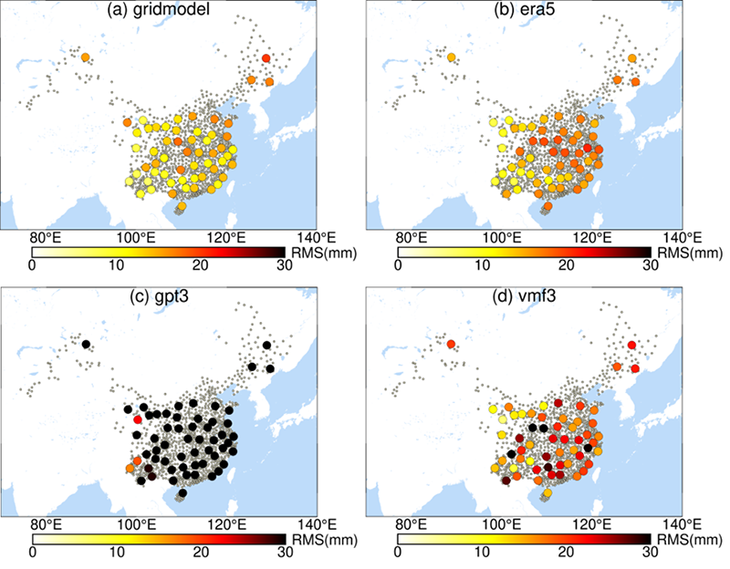
GNSS 2D Grid Products (RtZTD)
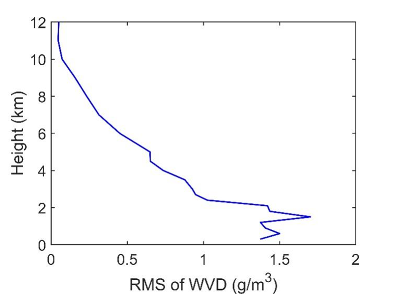
GNSS 3D Tomographic Products (TOM)
◊ Lou Y., Huang J., Zhang W., Liang H., Zheng F., Liu J. (2018) A New Zenith Tropospheric Delay Grid Product for Real-Time PPP Applications over China. Sensors. 18(1), 65. https://doi.org/10.3390/s18010065
◊ Zhang W., Lou Y., Liu W., Huang J., Wang Z., Zhou Y., Zhang H. (2020) Rapid troposphere tomography using adaptive simultaneous iterative reconstruction technique. Journal of Geodesy. 94(76). https://doi.org/10.1007/s00190-020-01386-4