NWM-Based Model Products
The development of Numerical Weather Models (NWM)- based tropospheric model products for high-precision tropospheric delay correction and water vapor retrieval is of significant importance for precise space geodetic data processing and applications. In recent years, the Collaborative Precision Positioning Research Group has developed Wuhan University's tropospheric model products using ERA5 reanalysis data and the ray-tracing technique (Zhou et al., 2020). The model product's accuracy and temporal-spatial resolutions are better than those of its international counterparts.
 Figure 1. Classification of Wuhan University tropospheric model products. A gray background indicates that the model products are still under construction
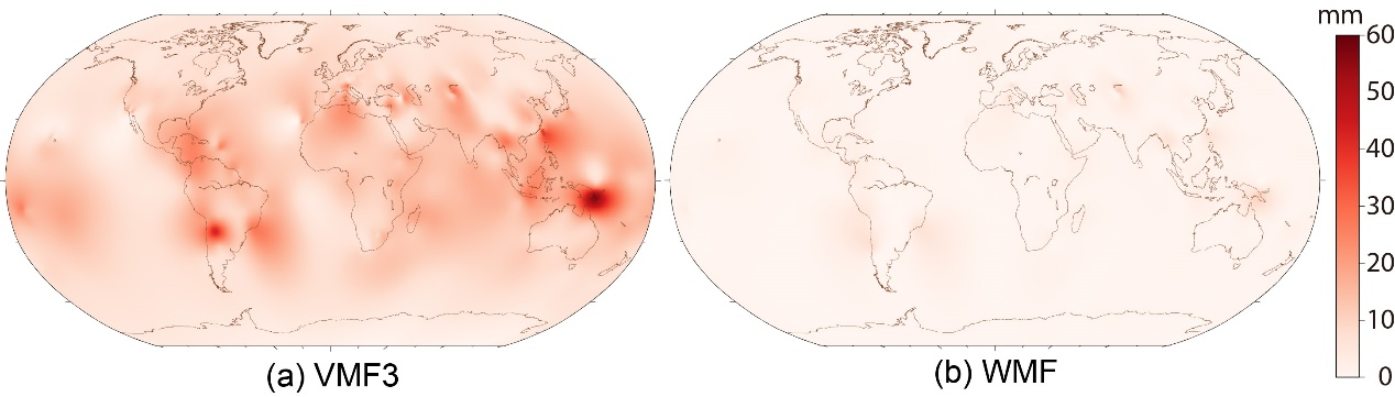
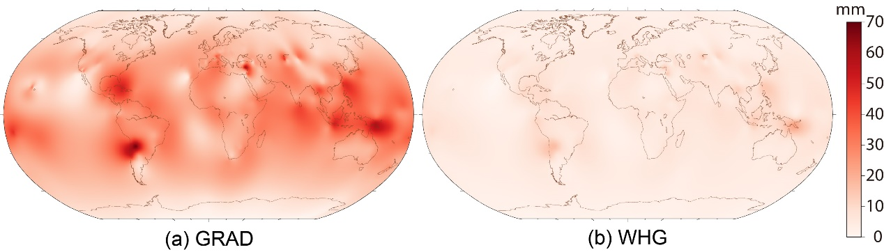
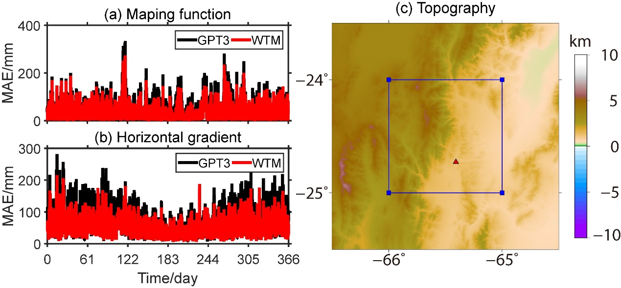
The model products primarily consist of three categories: mapping function product (WMF), horizontal gradient products (WHG), and comprehensive empirical model (WTM). Among them, the mapping function and horizontal gradient products target post-processing high-precision applications, while the comprehensive empirical model addresses real-time applications. As of now, the research group has developed site-wise model products covering the globally distributed 1,583 space geodetic stations, including those of the Crustal Movement Observation Network of China (CMONOC) and the National BDS Augmentation Service System. Corresponding grid-wise model products are still under construction (marked by a gray background).
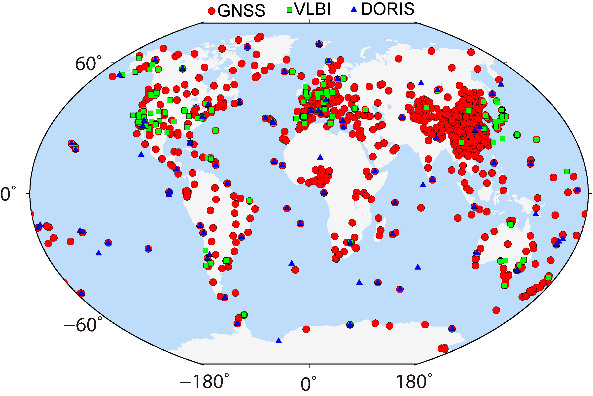 Figure 2. Space geodetic station distribution for Wuhan University site-wise model products
1. Hourly site-wise mapping function product (WMF-S)
2. Hourly site-wise horizontal gradient product (WHG-S)
3.Diurnal site-wise comprehensive empirical model (WTM-S)
Recommend citations
◊ Zhou Y., Lou Y., Zhang W., Kuang C., Liu W., Bai J. (2020) Improved performance of ERA5 in global tropospheric delay retrieval. Journal of Geodesy. 94(10):1–14. https://doi.org/10.1007/s00190-020-01422-3
◊ Zhou Y., Lou Y., Zhang W., Bai J., Zhang Z. (2021) An improved tropospheric mapping function modeling method for space geodetic techniques. Journal of Geodesy. 95(9):1–14. https://doi.org/10.1007/s00190-021-01556-y
◊ Zhou Y., Lou Y., Zhang W., Wu P., Bai J., Zhang Z. (2022a) Tropospheric second-order horizontal gradient modeling for GNSS PPP. Remote Sensing. 14(19):4807. https://doi.org/10.3390/rs14194807
◊ Zhou Y., Lou Y., Zhang W., Wu P., Bai J., Zhang Z. (2022b) WTM: The site-wise empirical Wuhan University tropospheric model. Remote Sensing. 14(20):5182. https://doi.org/10.3390/rs14205182
◊ Zhou Y. (2022) Research on high-precision tropospheric mapping function and horizontal gradient modeling methods for BDS/GNSS. PhD thesis. Wuhan University. https://link.cnki.net/doi/10.27379/d.cnki.gwhdu.2022.001209